
In 2016, I saw an article posted by my local new station about highlighting elevated formaldehyde levels in Bountiful, Utah: https://www.deseret.com/2016/7/12/20591870/pollutants-study-reveals-elevated-levels-of-formaldehyde-in-bountiful
The article stated that the Utah Department of Environmental Quality agency had not yet isolated a source for the pollutant, but the monitor at Viewmont High School (Where I graduated in 1994) is not far from an industrial area, I-15 and refineries.
This got me thinking about a way to use some of my radio controlled (RC) aircraft with a formaldehyde sensor and computer to log GPS, windspeed, and other useful data. Since there were no commercially available formaldehyde aerial dataloggers, I had to build one. Over the last half of 2016, I flew dozens of missions with homebuilt experimental data loggers. These were mostly cheap sensors on small Linux single board computers.
Aircraft I used were the Believer Twin-tractor 1960mm Mapping Plane and Skywalker 1680 V6-Wingspan 1720mm. Both worked well and were hand flown via FPV following a compass heading and altimeter I could see on my ground station. The most difficult part was the low quality formaldehyde sensors I was using. These were Metal Oxide Semiconductor (MOS) Sensors and Electrochemical Sensors, that were inexpensive but would fail often or weren’t logging accurately. I started adding multiple sensors to my data loggers and would average out the values in real time or in post-processing. After doing this for a couple months, I shared my results.
Collaborating with the Department of Clean Air, they introduced me to a local sensor developer Vaporsens and Angela Mitcham (https://www.linkedin.com/in/angela-mitcham/) the current Director of Business Development and Partnerships. Angela would eventually move on to Terahertz, another clever sensor firm as Director Of Business Development, then a similar role at Frost Methane Labs. I learned a lot about the quality of sensors
Leveraging my background in the oil and gas industry, a unique opportunity emerged when an oil company thermal mapping client sought assistance in locating methane and hydrogen sulfide (H2S) emissions. In response, I engineered a multi sensor data logger capable of capturing a spectrum of gases, and transformed an Ardupilot homebuilt multirotor into a versatile tool for environmental surveillance.
Later, while consulting for a survey company in Virginia, I presented findings at the 2022 SWANA East Coast Chapter, Joint Solid Waste and Recycling Conference. This presentation was directed to assist landfills with the approach towards multi-sensor data loggers. During landfill gas detection missions, I was also able to collect RGB data for photogrammetry for volumetrics, and thermal data to build radiometric mosaic GIS data to identify hot spots, underground fires and chemical reactions. http://www.swanava.org/home/past-events/2022-joint-conference
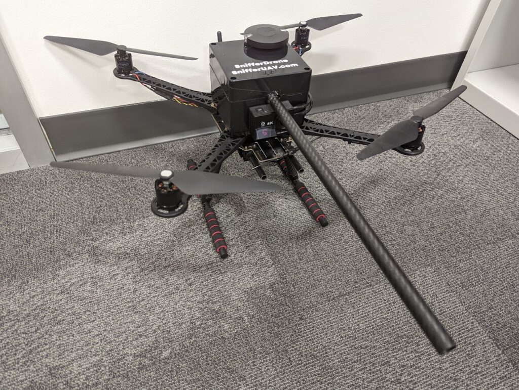
The work I started in 2016 resulted in the creation of MethaneMapper, a turnkey instrument designed for comprehensive environmental monitoring. MethaneMapper has the capacity to collect data on 14 different hydrocarbons, complemented by an error quality sniffer for enhanced reliability. Additionally, the inclusion of Tunable Diode Laser Absorption Spectroscopy (TDLAS) technology ensures precise methane detection, solidifying MethaneMapper as a state-of-the-art solution in environmental sensing.
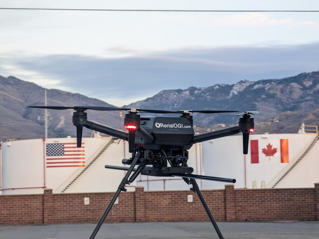
MethaneMapper is unmanned aircraft agnostic. Standalone mode for any aircraft, and integrated with real time display on the Sony Airpeak, and DJI Matrice 300/350, Mavic 3 Enterprise. Realtime display to the remote pilot in command what gas was observed, how much of the gas was observed and the location of the gas on a live map. MethaneMapper also collects this data onboard so pilots can use our web portal to convert the data into a Google Earth KML, or GIS Shapefile.
Looking ahead to 2024, we anticipate integrating a complete drone-in-a-box solution that will enable landfill and oil & gas companies to automatically deploy MethaneMapper. A facility director could deploy, then receive a dashboard of reports daily or even multiple times per day. Users could also deploy our optical gas imaging payload to gain more insight into methane leaks, identifying specific sources such as cracked wellheads or faulty gaskets. Here is a video I made of a leak from a wellhead at a landfill using OGI. Can you spot the leak?
Visit MethaneMapper.com for more info and updates.