
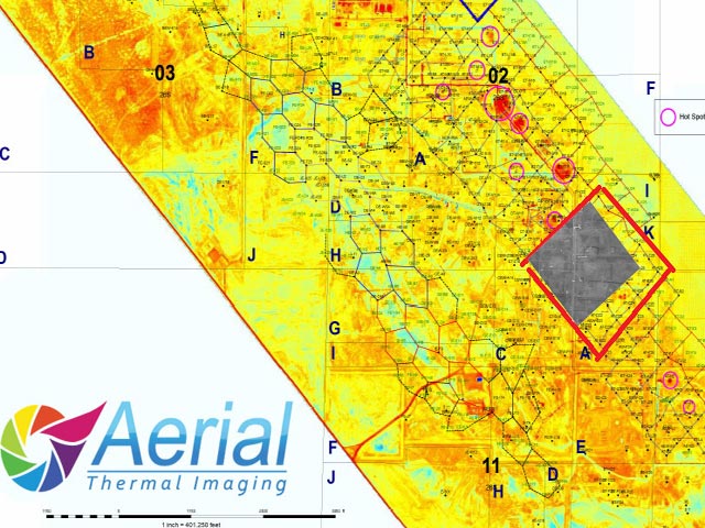
Radiometric stitching
We were the first to build and deliver large scale radiometric mosaic deliverables. We can help you collect superior images and stitch, or help you stitch images from your DJI, DRS or Flir thermal sensors.
Pollution Detection
Remote sensing used in environmental surveys with the goal to identify and locate illegal dumping of wastes that contaminate soil, water, and air with a range of toxic pollution including dioxins.
Aerial Mapping
LiDAR, Orthoimagery, Photogrammetry, Radiometric Thermal Mosaic, Infrared, Multispectral, Oblique Imagery, 3D Models, Bathymetric LiDAR, Topographic, Planimetric and corridor mapping.
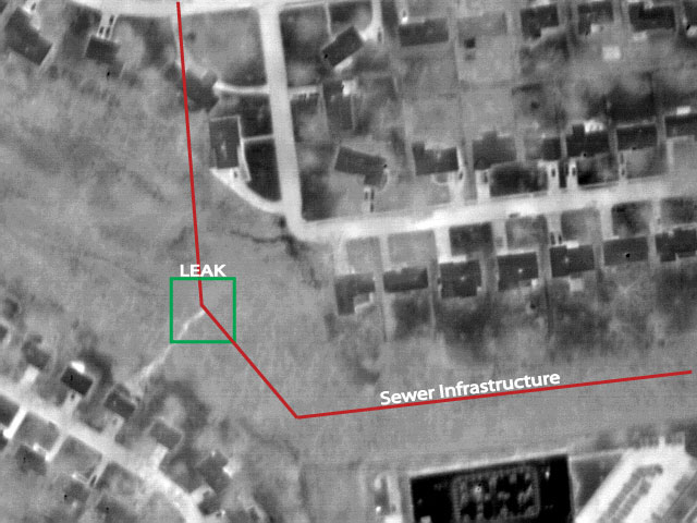
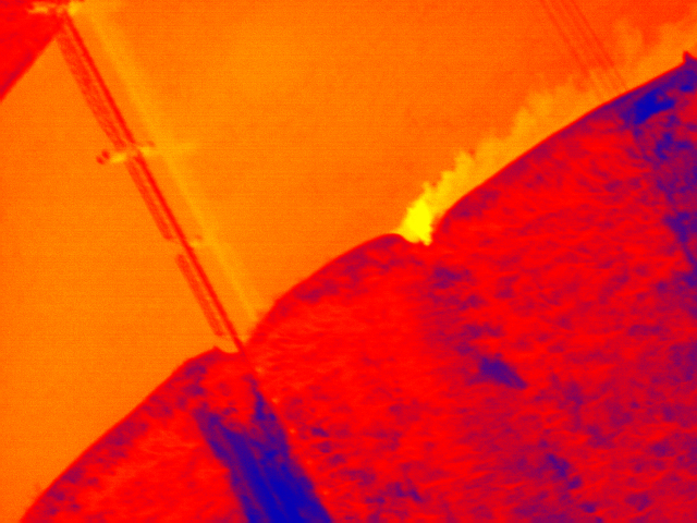
Leak Detection
Sewer leaks can occur from tree root invasion, soil slippage, seismic activity, loss of foundation due to washout, flooding and sewage back up, among other events.
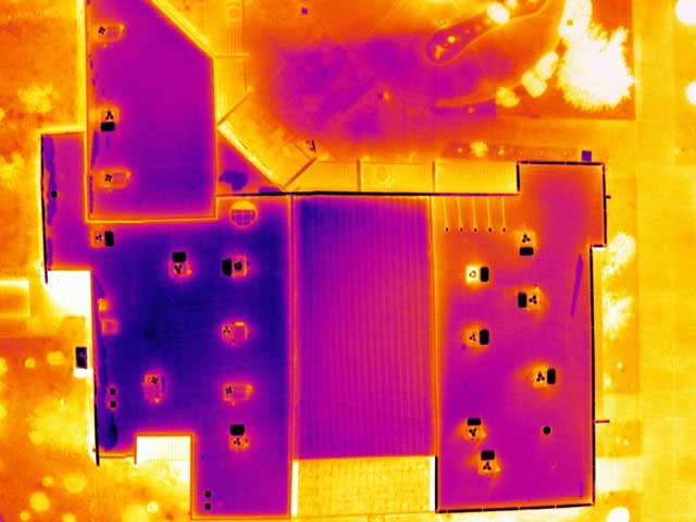
Roof Inspection
Facility directors, engineering departments and commercial roofers use our thermal / infrared imagery to make repairs where they are needed, avoiding complete replacement
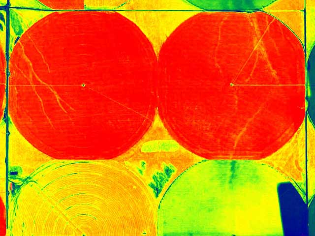
Agricultural Remote Sensing
Using invisible spectral bands, we can assist with chlorophyll content, water & fertilizer management, disease identification, phenotyping and more.